Programme:
June 16, 2025 – Workshop day 1
- 9:30-10:00 Registration
- 10:00-10:15 Opening
- 10:15-12:15 Keynotes' presentations
- Ismael Colomina (GeoNumerics) - On the 30th anniversary of EuroCOW: where does sensor fusion go?
- Jan Skaloud (EPFL) - Rigorous approach to bore-sight self calibration in airborne laser scanning - What's new after 20 years?
- 12:15-12:45 Coffee break
- 12:45-14:05 Session #1 - Aerial and UAV-based photogrammetric data acquisition and processing (J. Skaloud)
- F. Remondino, M. Muick, M. Cramer, K. Wenzel - A status quo in aerial photogrammetric mapping
- A. Kostrzewa, A. Płatek-Żak, P. Banat, Ł. Wilk - Open-source vs. commercial photogrammetry: comparing accuracy and efficiency of OpenDroneMap and Agisoft Metashape
- L. Morelli, G. Perda, S.Malek, F. Remondino, K. Legat - Night and day aerial photogrammetry
- Sponsor’s presentation: Kamil Wójcik (IGI) - Robust Aerial Navigation and Georeferencing in GNSS-Challenged Environments
- 14:05-15:00 Lunch
- 15:00-16:20 Session #2 - Lidar data processing and comparison (F. Remondino)
- T. Faitli, H. Hyyti, J. Hyyppa, H. Kaartinen, A. Kukko - A generic multi-lidar data batching strategy on the sensor driver level
- M. Pilarska-Mazurek, W. Ostrowski, P. Zachar, M. Czarnowicz - Comparison of DJI Zenmuse L1 and Riegl MiniVUX-3 UAV data for DTM generation in the forestry area for archaeological purposes
- F. Pöppl, A. Spitzer, A. Ullrich, N. Pfeifer - Airborne laser scanning for corridor mapping: georeferencing with tightly-coupled multi-view LiDAR
- Sponsor’s presentation: Jakub Krawczyk (OPEGIEKA) - 5 years of production experience in using AI for ALS data classification
- 16:20-17:00 Coffee break
- 17:00-19:00 Warsaw Old Town walking tour
- 19:00-21:00 Ice-breaker - Kameralna Restaurant, Mikołaja Kopernika 3 Street, 00-367 Warsaw, Google maps: https://maps.app.goo.gl/FrbRRkxzjVxKFpX99
June 17, 2025 - Workshop day 2
- 8:45-9:00 Registration
- 9:00-10:30 Session #3 - Calibration and configuration of sensors and systems (H. Meißner)
- K. Jacobsen - Self calibration of fused camera image
- R. Ladstädter, K. Gutjahr, R. Perko, H. Woschitz - Calibration and validation of Phase One industrial cameras
- J. Będkowski, M. Pełka, K. Majek, M. Matecki - Method for spherical camera with 3D LiDAR calibration and synchronization with example on Insta360 x4 and LiVOX MID 360
- M. Daakir, A. Bettiol - Stereobaseline: a flexible system for photogrammetric data acquisition in linear configuration
- 10:30-11:00 Coffee break
- 11:00-12:00 Session #4 - Assessment and evaluation of sensors (A. Rzonca)
- L. V. Jospin, J. R. M. Lahaye, J. Skaloud - Quality assessment of airborne image spectrometry data for the Aviris-4
- P. Zachar, Ł. Wilk, M. Pilarska-Mazurek, H. Meißner, W. Ostrowski - Assessment of UAV image quality in terms of optical resolution
- E.A. Gasińska-Kołyszko - The role of echosounder measurement in lidar point cloud calibration
- 12:00-13:00 Lunch
- 13:00-14:20 Session #5 - Georeferencing and orientation (I. Colomina)
- F. Vultaggio, P. Fanta-Jende, M. Gerke - Perspective-n-Point in practice: performance, robustness, and accuracy for mesh-based localisation
- G. Perda, L. Morelli, F. Remondino - Orientation of ambiguous image sequences with similar and repeated structures.
- A. Rzonca, M. Twardowski - Lidargrammetric co-matching and co-adjustment - a new method of photogrammetric and LiDAR data integration
- J. Somla, M. Mendela-Anzlik - Photogrammetric data acquisition in Poland in a scope of geopolitical situation
- 14:00-14:50 Coffee break
- 14:50-16:00 Session #6 - Validation of mobile mapping sensors for field applications (W. Ostrowski)
- M. Berbel, G. Sans, M. Blázquez, I. Colomina - Combining Galileo’s HAS and the E5 AltBOC signal for terrestrial mobile mapping
- T. Misaki, K. Ogawa, S. Nishiyama, M. Yamamoto, K. Kimoto - Application of MMS Data to Road Bridge Maintenance Management
- J. Będkowski, M. Kulicki, K. Stereńczak, M. Matecki - Affordable air-ground mobile mapping system for precise forestry applications
- M.A. Núñez-Andrés, A. Prades-Valls - Improving the continuous photogrammetric monitoring system
- 16:00-16:15 K. Bakuła & D. Gotlib – Summary of technical sessions and invitation to technical trip
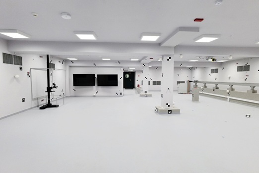
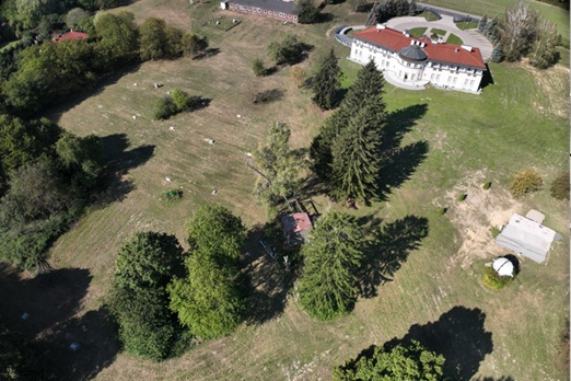
June 18, 2025 – Technical trip:
Scientific and Educational Centre Józefosław – CENAGIS (https://cenagis.edu.pl/en/labs/)
- 8:50-9:30 Bus travel (Meeting Point 8:50 - Rektorska 4 https://maps.app.goo.gl/dHp8m6TyPAPzPeGSA)
- 10:00-12:00 Visiting laboratories for lidar calibration and networking
- 12:00-12:30 Bus travel back home to the City Centre
Our sponsors